There’s no question that this circular Edale walk to Mam Tor is challenging in places, but it shows off some of the most spectacular views in the Peak District and definitely repays the effort. For a true countryside day out that gives you a real taste of this part of the world, it’s hard to beat.
You follow the Pennine Way out of the pretty village of Edale, with stunning views all across the Edale Valley to Mam Tor, and then follow farm trails to the lovely hamlet of Upper Booth. From Upper Booth you climb up on to Rushup Edge and along the ridge to the summit of Mam Tor, all the time with the most amazing views to both sides of you, of the Hope Valley in one direction and back across the Edale Valley in the other. From Mam Tor you walk along the iconic Great Ridge to Hollins Cross, and then down on hill trails and country lanes back to Edale. A great classic Edale Walk Circular that rewards you well.
The walk starts and ends at Edale train station (SK 12243 85319; Postcode S33 7ZP; ///avocado.grudge.inefficient) so it’s easily accessible by public transport.
This is a walk of just over 8 miles. The terrain is rocky and very uneven in places, and there are a few steep ascents. There are stiles, squeeze stiles and narrow footbridges. There are two wonderful pubs and two great cafés in Edale at the start or end of the walk, but no other refreshment stops on the way, unless you’re lucky enough to catch the local Hope Valley ice creams for sale when you reach Upper Booth Farm. There are public toilets opposite the train station in Edale. Allow 3-4 hours to complete this walk at a moderate pace, allowing for rest stops to take in the views.
Note: This route is provided in good faith and is correct at the time of publication. Please be aware that routes may be diverted over time as paths and access are altered, particularly in farming areas. Our directions should not be used instead of a map. You should always take a map with you to cross-reference the route.
The Walk
1. Begin this Edale walk from Edale train station through the car park, turn left to walk down the lane that leads past the Penny Pot Café, perfect for tea and cake to set you up for the day. Just past the café turn left again to walk into Edale village. You will soon pass the Rambler Inn on your left, which serves good pub food and real ales and has a great pub garden. It is dog- and child-friendly. Continuing on, you will walk past the Moorland Visitor Information Centre which is on your right. This is a useful information centre and has a small gift shop.
2. Continuing on the same road into
Edale, you will pass the pretty church of the Holy and Undivided Trinity on
your left, and then a further café, Coopers Café. Finally, before leaving the village behind, the
Old Nag’s Head pub will appear in front of you to the right. This is another fabulous country pub, friendly
for children, dogs and muddy boots.
The Old Nags Head – Edale Walk circular to Mam Tor
3. As you draw level with the Old Nag’s Head pub, turn left to walk between two stone walls at the very start of the Pennine Way, also signposted for Upper Booth. The Pennine Way is one of Britain’s best known long distance footpaths, stretching for 268 miles from Edale to Kirk Yetholm in the Scottish Borders. Fortunately we’re only doing a very small section of it today!
Edale Walk Circular passing the official start of the Pennine Way
4. Follow the path gently up as it passes
beneath trees with a small stream running to the right. At the top of the path, go through a gate and
then bear left through another gate into open moorland, still following the
Pennine Way. The path is partly paved
across the fields and very easy to follow.
It passes through a succession of small gates. To your left the Edale Valley stretches out impressively,
with (L-R) Lose Hill, Back Tor, the Great Ridge, Mam Tor and Rushup Edge towering
above the valley floor. To your right
you can see the beginnings of the vast slopes of Kinder Scout.
Edale Walk Views are Spectacular
5. Keep following the path onwards. Where you reach a fork in the path, take the left hand track and follow as it descends gently down. You will pass through a series of further gates and eventually track alongside a stone wall on your left before reaching a farm, Upper Booth Farm. If you’re lucky they might be open for sales of local ice creams when you reach them.
Edale Walk Circular
6. Walk through the farmyard and emerge
on to the quiet lane, with a red telephone box in front of you. Cross over the lane and the route continues straight
on, walking to the right of the telephone box and along a narrow path into
woodland. After a short while the route
crosses a little brook, actually the River Noe, by way of a narrow
footbridge. After the footbridge the
path bears left and quite steeply up.
7. Emerging once more into open fields,
follow the footpath signposted for Chapel Gate and Rushup via Dalehead. This path is well marked for Dalehead and goes
straight on across the fields, over a stone stile and through a cluster of farm
buildings, some disused. Again, the
views along the Edale Valley to the left are magnificent.
Edale Walk wide open views
8. Leaving the last of the farm
buildings behind, the path continues with a stone wall to the left, which
gradually gives way to a fence. As the
fence curves off to the left, note that you should turn right and slightly
uphill to follow the path. The path goes
over the top of the railway line here and you can see a stone building housing
a vent.
9. Continuing on, the path bears left
and crosses another stream by way of a footbridge, coming out by the National
Trust’s Dalehead Bunk House. Turn right on
the lane, signposted to Whitemoor Clough, to walk in front of the Bunk House,
and then turn left over a stile before a wide gate and cattle grid, immediately
after the end of the building. The path
crosses fields and goes over a stile beside a small area of woodland. It then heads up quite steeply to Rushup
Edge, the ridge you can see above you.
10. When you reach the ridge, the hill path is joined by the Chapel Gate Track. Continue straight on, now following the broad track, signposted to Chapel en le Frith. Continue on this same track, ignoring a paved path off to the right. You will shortly reach a further T-junction of paths, at which you should follow the track as it bears left and runs alongside a stone wall on the right. You are now on Rushup Edge.
Edale Walk Circular taking in Mam Tor
11. As you walk along the ridge, look out for a fenced tumulus close to Lord’s Seat on your left. Lord’s Seat is the highest point on Rushup Edge, at 550m. The tumulus is a roughly circular bowl barrow standing 15m high, a funerary mound dating from the Bronze Age. It has never been excavated and is believed to contain rare intact archaeological remains.
12. Continuing on, you will soon see the
vast sweep of the Edale Valley, through which you walked earlier, to your left,
and the Hope Valley stretching out to your right. Ahead, you will see the path snaking up Mam
Tor to the summit trig point. As you
near Mam Tor you will reach a fork in the path.
You can take either route, but we recommend taking the lower track to
the right, which has more even terrain. Go
through a gate at the bottom of the track and cross the road carefully to begin
your ascent up Mam Tor.
Edale Walk en route to the Mam Tor trig point
13. Go through the gate at the bottom of
the path up to Mam Tor, and follow the well-laid path as it turns right and
heads up a series of steps to the trig point at the top. Mam Tor literally means Mother Hill. Standing at 517m high, it is the site of a
late Bronze Age hill fort, one of the earliest in Britain and also one of the
largest, covering an area of around 16 acres. It’s also the site of an Iron Age village, when
more than a hundred timber round houses were built on flat level platforms on
the hillside. These days Mam Tor is a
very popular visitor spot so you may have to queue to take a photograph at the
trig point, but you’ll find that the hordes disappear quite quickly as you continue
on the walk.
14. To continue, carry on along the same well-laid
path, leaving the trig point behind you.
You are now on the Great Ridge, with wonderful views on both sides. To your right you can see down on to the
curving ‘Broken Road’, once the A625, which was closed in 1979 when its upkeep
became too costly because of the regular landslips from Mam Tor.
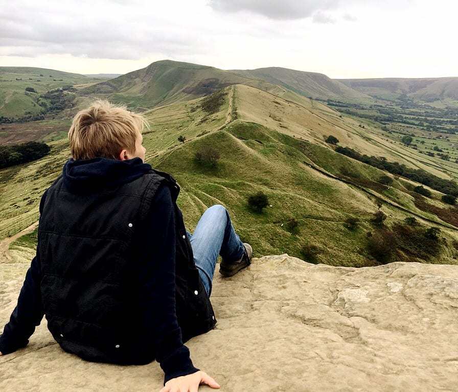
View from from The Great Ridge on Mam Tor
15. Walk through a couple of gates until you reach a squat, round stone marker at a crossroads of paths. This is known as Hollins Cross. Coffins from Edale were once carried up and over the Great Ridge via Hollins Cross to Hope Church, before the church at Edale was consecrated. At Hollins Cross you are faced with a number of different paths, but you need to turn sharp left and follow the route that almost doubles back on the way you have just come from, lower down the hill. This path is uneven and rocky in places, so do take care.
Edale Walk Circular heading back to Edale from Mam Tor
16. At a fork in the path, take the left
path that continues to run along the hillside.
This path is clear and easy to follow, continuing through a series of
gates and into a beautiful little hawthorn woodland. Continue along the path until it reaches a
lane in front of a farmhouse. At this
point walk through a gate on to the lane and turn right to follow the lane down
the hill, signposted to Edale. It is a
beautiful, tree-lined route, eventually emerging out into open countryside with
a stone wall to your left and a hedge to your right.
Edale Walk Mam Tor Circular
17. The lane eventually ends and meets up with a road. Turn right on the road and walk for approx 100 metres. Be aware that there is no footpath. When you see a road that leads off to the left, cross over the road and take the left hand turn. This will lead you back to Edale train station and your starting point on your left.
This Edale Walk is part of the collaboration to link up train stations with walks with The Outdoor City
A route in a series that are accessible from mainline railway stations from Sheffield, a collaboration with The Outdoor City#trainstationwalks
Edale Walk taking in Rushup Edge, Mam Tor, Great Ridge and Hollins Cross
5 Peak District Train Station Walks in the Peak District Hope Valley
The Let’s Go Peak District Hope Valley Train Station Walk Series are all circular, and if you set yourself the challenge to walk all of them you will have walked ~28 miles, and taken in many wonderful views.


 1")
 2")
 3")
 4")
 5")
 6")
 7")
 8")
 9")
 10")
 11")
")
")
")
")
")
")
")
")
")
")
")
 - 2 miles")
")
")
")
")
")
")
")
")
)