

Youlgreave Walk : Details
Distance 7.6 miles
Time Approx 3-4 hours
Terrain Field paths and quiet lanes, rocky and uneven in places
Accessibility Uneven ground, steep steps, gates, stiles and squeeze stiles
Start and End Point SK 21181 64379; Postcode DE45 1WL; ///enveloped.probing.enjoy
Map Ordnance Survey Explorer OL24
Youlgreave Walk : Introduction
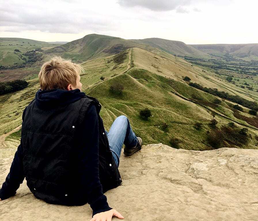
This wonderful walk is an absolute gem, starting and ending in the very pretty village of Youlgreave. The route follows the crystal-clear River Bradford through shady woodland, before heading across open countryside to Lathkill Dale. It then follows the course of the River Lathkill through dramatic limestone gorges before returning along field tracks and country lanes to the start point.
This is a walk of 7.6 miles. There are stiles and squeeze stiles, although no terribly steep ascents. Youlgreave is well served for cafes and pubs, as well as shops to buy picnic supplies for an en-route stop. There is plenty of car parking available in Youlgreave, both in car parks (fees apply) or on the road side (please park with consideration for local residents). Allow 3-4 hours to complete this walk at a moderate pace, more if you allow for rest stops and a lunch break.
Note: This route is provided in good faith and is correct at the time of publication. Please be aware that routes may be diverted over time as paths and access are altered, particularly in farming areas. Our directions should not be used instead of a map. You should always take a map with you to cross-reference the route.
Youlgreave Walk : Directions
1. The walk sets off from the pretty All Saints Church in Youlgreave (SK 21181 64379; Postcode DE45 1WL; /// enveloped.probing.enjoy). There is usually plenty of parking on the roadside close to the church, although please park with consideration for local residents. There is also a public car park close by in the village (fees apply). Walk down Bradford Road, which runs to the side of the church, and follow the quiet road downhill.
 1")
2. As the road bends right and heads towards the River Bradford, take the public footpath on the right just before the river. Head through the wooden gate and follow the obvious path through the pretty dale with the river to your left.
 2")
3. As the path ends and joins a lane, go through a squeeze stile and turn immediately left, crossing the river via a raised path. Once you’ve crossed the river go through a gate and turn immediately right, to take the path signed The Limestone Way. The river is now on your right.
 3")
4. Follow this lovely path until you reach a wide stone bridge over the river, still signposted for The Limestone Way. Cross the bridge and head away from the river, taking the left hand path where the track forks. Follow this winding path up through trees, now with the river on your right some distance below you.
 4")
5. Where the path ends and joins a quiet road, go through a gap in the wall and turn right. Walk along the road a short distance and then go ahead through a small wooden gate to walk up through a grassy field, still following signs for The Limestone Way. At the top of the field go over a stile to join another road, and turn left. Follow the quiet road for a short distance and then take a path on the right through a small wooden gate, still following signs for The Limestone Way.
6. Head up and diagonally left across the field, always staying on the most obvious track where the path forks. Go through a small wooden gate in a stone wall to follow a narrow path beside trees. There’s a beautifully-positioned picnic bench here for a halfway break!
 5")
7. At the end of the path, go through a wide wooden gate and turn left on to a quiet road. Where this quiet road joins a slightly busier road, cross straight over the road and take the footpath almost immediately opposite, to rejoin The Limestone Way on an obvious path through fields. There are two step stiles over stone walls on the way.
8. Go through a small wooden gate, still signposted for The Limestone Way, and across a further grassy field into woodland. This is Low Moor Wood, purchased by the Peak District National Park Authority in 2001 to celebrate the 50th birthday of the Peak District.
 6")
9. Follow the path through the woodland and out through a further wooden gate to emerge into a grassy field. Follow the obvious path diagonally left and go through a small wooden gate in a stone wall, heading towards a line of trees. Go through a further gate into the trees and follow the obvious path through the wood towards another small wooden gate. Cross a grassy area and go through a further two gates to emerge into open fields.
 7")
10. Cross the fields following the obvious path towards a kissing gate in a stone wall. Go through the gate and follow the path across another field downhill, signed to Cales Dale. Go through a further kissing gate, and descend into Lathkill Dale, following a steep set of steps that zig-zag downhill.
11. At a four-way fingerpost sign, turn right and follow the path signed to Lathkill Dale. This pretty winding path goes through trees and then emerges into a clearing, with the towering limestone cliffs of Lathkill Dale ahead of you.
 8")
12. Cross over a small wooden footbridge and then turn immediately right, to walk with the clear, shallow River Lathkill on your right. Keep following the obvious path through the gorge, through a succession of gates and over a squeeze stile, always with the river to your right.
 9")
13. You will pass a pretty collection of waterfalls and, some time later, a picturesque arched footbridge. Do not cross the footbridge, but instead keep following the path ahead. Look out for the natural sink holes on your left, with explanatory signs from Natural England, and further on along the gorge watch out for the caves in the cliffs on your left.
14. Emerge through a gate in front of a small collection of houses, directly opposite the lovely Lathkill Lodge. Turn right immediately before the houses and cross the stone footbridge over the river ahead of you, signed ‘Right of Way’. Turn left after crossing the river and follow the winding path up through trees.
 10")
15. Go through a wide gate at the end of the path, and follow the obvious path to the left across the grassy field towards a farm. Follow the public footpath signs through the farmyard, and then out through a further gate, signed towards Youlgreave and Middleton.
16. The path forks soon after passing through another gate, and you should take the left hand fork to walk alongside the stone wall, keeping the wall on your left. Go over a step stile over a stone wall, and continue walking with the wall on your left. There are wonderful views to the village of Over Haddon.
17. Go over a further step stile and cross a quiet lane, taking the footpath that is immediately ahead of you through two squeeze stiles. Follow the obvious path across fields through a succession of gates, and along a country lane between two stone walls. There are views to Youlgreave village to your left. On reaching a T-junction with a quiet road, turn left and head downhill, with the village soon coming into view ahead of you.
 11")
18. On reaching the village, follow the road until it emerges in front of the Bull’s Head pub. Turn left and walk towards the church, to return to your starting point.
 12")
Stay Awhile!
For a great place to eat before or after your walk, or stay overnight when visiting Youlgreave, we recommend Farmyard Inn in the heart of the village. It serves delicious home-cooked food and has four spacious, comfortable guest rooms available on a Bed & Breakfast basis.
 14")
Love this walk? Here are a few more you might enjoy…
For a shorter Lathkill amble, try the Monyash & Lathkill Dale Walk (4 miles), or explore Monsal Dale on Ashford in the Water via Monsal Dale (6 miles). Combine with the pretty Bakewell via Ashford-in-the-Water (6 miles), or discover a lesser‑known dale at Stoney Middleton via Coombs Dale (4.75 miles). Still looking? Explore all our Peak District walks.
)