



Wildboarclough Circular via Shuttlingsloe (7 miles)
A classic Peak District circuit that delivers maximum variety for minimal mileage. This challenging route ascends the ‘Matterhorn of Cheshire’ (Shutlingsloe), traverses the wild moorland edges of Wildboarclough, and descends into the serene, pine-scented valleys of Macclesfield Forest. This walk is a masterclass in the diverse landscapes of the Eastern Peaks.
⚠️ Please note: This route has been created and shared by an Outdoor Active community member. It has not been checked or verified by Let’s Go Peak District. Please read the full walk description carefully, check weather and ground conditions before setting out, and look to community reviews and comments on Outdoor Active for up-to-date feedback. Always follow the Countryside Code.
View Full Route on Outdoor Active ↗A Walk of Two Halves (and a Mountain)
If you are looking for a walk that feels like three different adventures rolled into one, the circuit from Wildboarclough to Shutlingsloe and Macclesfield Forest is the perfect contender. This isn’t a walk that settles for one view; it actively seeks out the best of the Peak District’s contrasts.
The route begins deep in the valley, climbs steeply to a prominent summit, traverses open sheep-grazed pasture, and finally plunges into the quiet, commercial forestry of Macclesfield Forest. It is a loop that rewards the effort of the climb with the sheer variety of the descent.
Part 1: Wildboarclough and the Ascent
The walk starts in the hamlet of Wildboarclough, a name that evokes the area’s wilder past. Nestled under the shadow of the hill, you immediately begin the strenuous, lung-burning climb towards the summit of Shutlingsloe.
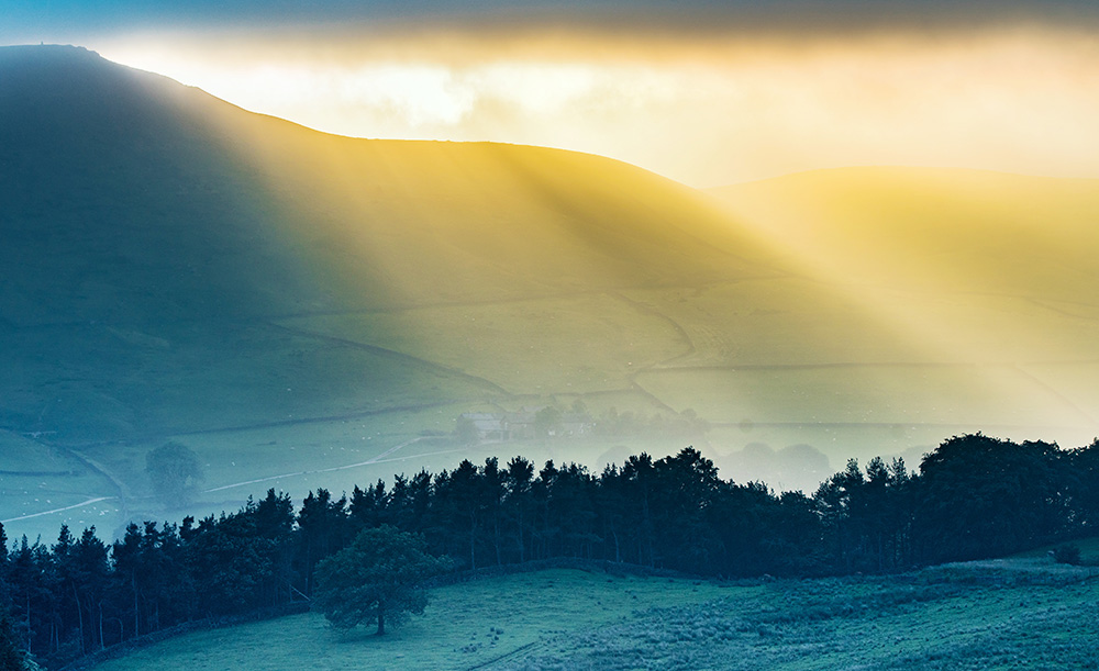
Standing at 506 metres, Shutlingsloe is often referred to as the “Matterhorn of Cheshire” due to its distinctive, steep, pointed peak. Though small by Alpine standards, its prominence in the landscape makes it a formidable challenge. As you gain height, look back to see the valley floor dropping away, with the twisting river and dry-stone walls shrinking beneath you.
Part 2: The Summit and The Ridges
Upon reaching the trig point at the summit of Shutlingsloe, you are rewarded with a 360-degree panorama. To the north, the rolling hills of Cheshire stretch out towards Manchester; to the east, the forbidding gritstone edges of Kinder Scout sit on the horizon.
From the summit, the path follows the edge of the hill down towards the Gritstone Trail. This long-distance footpath weaves along the ridge, offering a “walkers’ highway” that allows you to traverse the hills with the summit constantly looming behind you as a visual anchor. This section is particularly wild; the wind is sharp, and the ground is rough, with the view punctuated by the “odd sheep” balancing expertly on the steep slopes.
Part 3: Macclesfield Forest and The Return
As you descend from the open moorland, the landscape changes drastically. The dry-stone walls turn to dense woodland as you enter Macclesfield Forest.
This is a working forest, managed for timber and wildlife, but it feels more tranquil than the exposed tops. The route here follows the contours of the hillside, often running alongside cloughs (steep-sided valleys). Here, the sound of the wind is replaced by the gurgling of water and the scent of pine needles.
The path often skirts the banks of Ridgegate Reservoir, a beautiful spot to pause and catch your breath. The water acts as a mirror, reflecting the forest and the sky, providing a stark contrast to the barren summit you conquered an hour earlier.
The Final Stretch
Leaving the forest, the path winds back across green fields towards Wildboarclough. By this point, the legs are tired, and the sight of the pub (The Crag Inn) in the valley is a welcome one. It is only when you look back up that you realise how far you have come—the Shutlingsloe peak now looks small and distant, a silent guardian watching over your final steps.
🥾 Explore Near Wildboarclough Circular via Shuttlingsloe (7 miles)
Discover walks, attractions, pubs, and bus stops within the local area
- Buxton Visitor Centre 5.6 miles
- Macclesfield Forest Walk (8 Miles) ✨ NEW 1.7 miles
- Three Shires Head (3.8 miles) ✨ NEW 1.8 miles
- Shining Tor and Goyt Valley (7 miles) ✨ NEW 2.4 miles
- Buxton Circular to Errwood Reservoir (9 miles) ✨ NEW 4.6 miles
- The Duke at Burbage 4.6 miles
- Poole’s Cavern 4.8 miles
- Noonology 5.4 miles
- Gradbach Mill and Farmhouse 1.7 miles
- Quarnford Lodge 3 miles
- The Park Apartments, Buxton 5.3 miles
- Best Western Plus Buxton Lee Wood Hotel 5.5 miles
- Poole’s Cavern 4.8 miles
- Go Ape! Treetop Adventure 4.8 miles
- Buxton Opera House & The Pavilion Arts Centre 5.5 miles
- The Buxton Crescent Experience 5.6 miles
- 🚌 No bus stops found within 2 miles. Try checking nearby villages or towns.
🎪 Coming Up
📍 Distances are straight-line approximations.
)