



Castleton and Bradwell Moor Circular Walk (7 miles)
A magnificent 7-mile circular walk from Castleton, linking historic landmarks with wide-open moorland. This route visits the peaceful Church of Saint Edmund, the Castleton War Memorial, the imposing ruins of Peveril Castle, and the breezy summit trig point on Bradwell Moor. Along the way, enjoy superb views over the Hope Valley and, on fine days, watch fixed-wing gliders soaring from Abney Gliding Club.
⚠️ Please note: This route has been created and shared by an Outdoor Active community member. It has not been checked or verified by Let’s Go Peak District. Please read the full walk description carefully, check weather and ground conditions before setting out, and look to community reviews and comments on Outdoor Active for up-to-date feedback. Always follow the Countryside Code.
View Full Route on Outdoor Active ↗Castleton and Bradwell Moor Circular
This rewarding circuit starts in the heart of Castleton, a village famed for its show caves, Blue John stone and dramatic setting beneath Mam Tor. Before you even lace your boots, it’s worth taking a moment to appreciate the scene: Losehill and the Great Ridge form a spectacular backdrop to the north, while the limestone crags of Cave Dale hint at the walk to come.
Saint Edmund’s Church
Tucked away from the main street, the Church of Saint Edmund is a place of quiet reflection and a fitting place to begin or end a walk. The church dates back to the 12th century, with a simple Norman arch and later medieval additions. Its stone walls and calm churchyard offer a moment of stillness before the climb ahead, adding a layer of human history to the surrounding landscape.
Castleton War Memorial
A short distance from the church, the stone war memorial cross stands prominently in the village centre. It serves as a focal point for remembrance, inscribed with names that tie the village’s past to the windswept moors you’ll soon explore. Pausing here brings home the strong sense of community and continuity that defines this part of the Peak District.
Peveril Castle
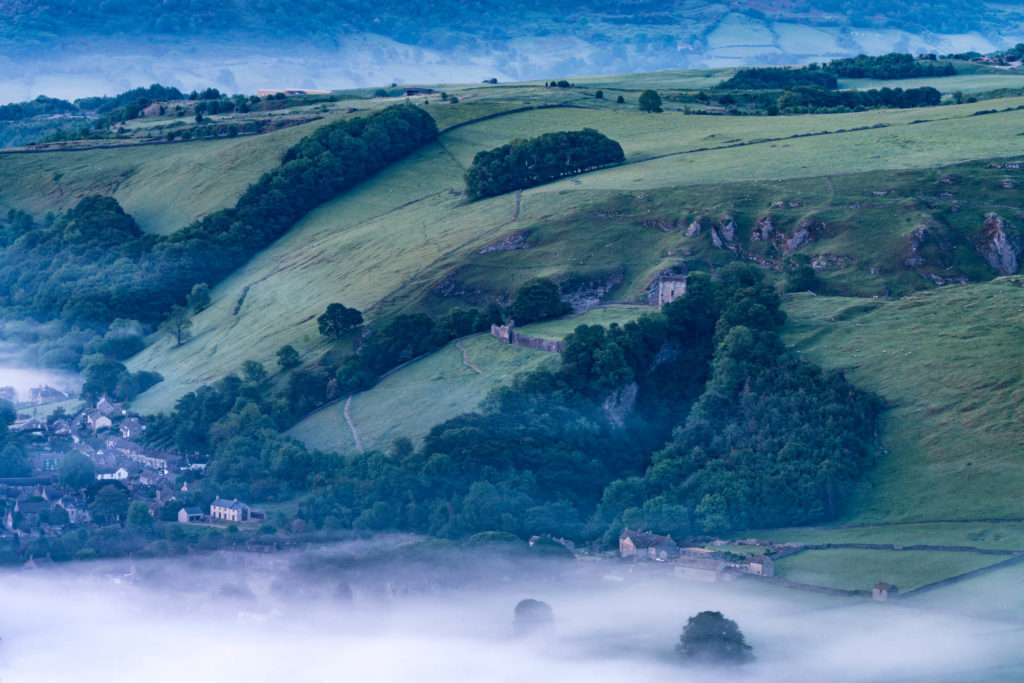
The walk climbs steeply out of Castleton, passing the dramatic remains of Peveril Castle. Perched on a limestone bluff high above Cave Dale, this Norman stronghold was founded by William Peveril, believed to be an illegitimate son of William the Conqueror. The keep, built in 1176 by Henry II, still commands breathtaking views over the Hope Valley. Even if you don’t enter the English Heritage site, the sight of its crumbling walls against the sky is unforgettable, especially from the path winding up through the gorge below.
Bradwell Moor and the Trig Point
Leaving the castle behind, the route heads onto more open ground, crossing the rolling, heather-clad expanse of Bradwell Moor. Here the atmosphere changes: the village chatter fades, replaced by the sound of wind and skylarks. The trig point on Bradwell Moor marks the highest section of the walk and offers a true sense of space. The views stretch from Kinder Scout’s plateau in the west, around to the Great Ridge and down the length of the Hope Valley — a spectacular 360-degree panorama on a clear day.
Abney Gliding Club
From the high moorland on a fine weather day, look towards the sky to the south-east. You might spot sleek fixed-wing gliders taking off from Abney Gliding Club, catching thermals and circling silently overhead. It’s a magical addition to the walk — the elegance of the gliders contrasting with the rugged terrain below, and a reminder that you’re sharing this landscape with those who take to the air.
Hope Valley Views
Throughout much of this walk, the Hope Valley unfolds beside you. The patchwork of green fields, stone-walled boundaries and scattered farmsteads creates a classic Peak District vista, framed by the edges of Kinder and the long spine of the Great Ridge. The interplay of light and shadow across the valley, especially in autumn or late afternoon, makes this a photographer’s dream.
A Community Walk to Savour
This route combines history, remembrance and wild moorland in equal measure, making it ideal for a community outing. At around 7 miles with some steep ascents, it offers a satisfying challenge without being overly demanding. Sturdy boots are recommended, and the weather can change quickly on the exposed moor, so bring layers and a waterproof. In Castleton, you’ll find plenty of cafes and pubs for a well-earned drink or meal at the end — a perfect way to round off a memorable walk.
🥾 Explore Near Castleton and Bradwell Moor Circular Walk (7 miles)
Discover walks, attractions, pubs, and bus stops within the local area
- Castleton Visitor Centre 0.1 miles
- Castleton Circular Walk via Mam Tor (5.5 miles) ✨ NEW 0.1 miles
- Hope Village to Hope Cross Walk (6.7 miles) ✨ NEW 1.9 miles
- Edale to Mam Tor (7.5 miles) ✨ NEW 2.3 miles
- Edale to South Head Circular (10 Miles) ✨ NEW 2.8 miles
- Ye Olde Cheshire Cheese Inn 0.1 miles
- The Peak Hotel 0.1 miles
- The Poachers Arms 1 miles
- Newfold Farm 2.6 miles
- The Yondermann Cafe 4.9 miles
- Cintra’s in Hathersage 5 miles
- Peak Cottage Collection 0.1 miles
- The Peak Hotel 0.1 miles
- Ye Olde Cheshire Cheese Inn 0.1 miles
- The Poachers Arms 1 miles
- Peak Cavern 0.2 miles
- Peveril Castle 0.2 miles
- Speedwell Cavern 0.7 miles
- Treak Cliff Cavern 0.9 miles
- 🚌 Visitor Centre (adj) → BLUE 0.1 mi BLUE ✨ NEW 📋 Timetable
- 📍 Distances are straight-line (as the crow flies) and approximate.
🎪 Coming Up
📍 Distances are straight-line approximations.
🗓️ Plan Your Day
Nearby services: 62, 173, 271, 272, BLUE · Live times
)