



Edale to South Head Circular (10 Miles)
This challenging 10 mile circular walk from Edale takes in some of the finest high moorland scenery in the Peak District. The route follows the Pennine Way to Jacob’s Ladder before climbing to the summit of Mount Famine and South Head. The walk continues across the wild expanse of Brown Knoll. The return leg descends via Chapel Gate and follows quiet footpaths back to the start. With significant ascent and remote terrain, this walk is suited to experienced hikers with good navigation skills.
⚠️ Please note: This route has been created and shared by an Outdoor Active community member. It has not been checked or verified by Let’s Go Peak District. Please read the full walk description carefully, check weather and ground conditions before setting out, and look to community reviews and comments on Outdoor Active for up-to-date feedback. Always follow the Countryside Code.
View Full Route on Outdoor Active ↗The Peak District is a walker’s paradise, and few routes capture its wild, untamed character as completely as this circular walk from Edale. Spanning approximately 11 miles, this demanding trek takes in some of the most dramatic high moorland in the national park. From the iconic Pennine Way and the famous Jacob’s Ladder to the remote summits of Mount Famine and Brown Knoll, this walk offers a true immersion in the landscape of the Dark Peak. With significant ascent, exposed terrain, this is a route for experienced hikers seeking adventure and solitude.
Jacob’s Ladder
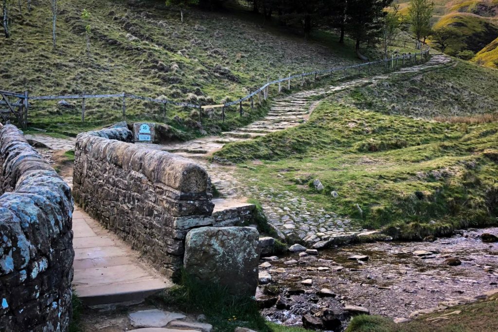
Jacob’s Ladder is one of the most iconic landmarks on the Pennine Way. It is a steep, stone-stepped path that climbs the flank of Kinder Scout, offering a direct and strenuous ascent onto the moorland plateau. The path was originally a packhorse route, used for centuries to transport goods across the hill. The stone steps were laid to make the climb easier for horses and their loads, but they still present a formidable challenge to modern walkers.
The name Jacob’s Ladder is thought to have biblical origins, referring to the dream of Jacob in which he saw a ladder reaching to heaven. The steepness of the climb certainly evokes the idea of ascending to another world, and the views from the top are a fitting reward for the effort. As you climb, the valley below opens up, and the distant hills of the Peak District come into view.
Edale Cross
Edale Cross is a simple but evocative monument. It stands alone on the moor, exposed to the wind and weather, a silent witness to centuries of human passage across this wild landscape. The cross is a popular spot for walkers to pause and take in the views, which extend across the Edale Valley to the south and the Kinder plateau to the north.
South Head and Mount Famine
Mount Famine is a prominent hill that rises to the west of Kinder Scout. It offers superb views across the Peak District, including the Kinder plateau, the Edale Valley, and the distant hills of the Dark Peak. The name Mount Famine is thought to derive from the Old English “fægen,” meaning joyful, although the bleak moorland landscape seems anything but joyful on a wet and windy day.
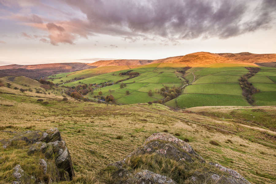
South Head is a fine viewpoint, offering panoramic vistas across the surrounding countryside. To the north, the Kinder plateau stretches away, a vast expanse of moorland and bog. To the south, the rolling hills of the Peak District fade into the distance. The summit is quiet and remote, a place to enjoy the solitude and the sense of being on top of the world.
Chapel Gate and the Return
From Brown Knoll, the route follows the path southwards until it reaches Chapel Gate. Chapel Gate is a historic track that crosses the moorland, connecting Edale with the villages of the Hope Valley. The track has been used for centuries, and it is still a popular route for walkers and cyclists.
Practical Advice for Walkers
This walk is demanding and should not be undertaken lightly. The total distance is approximately 10 miles, with significant ascent spread across the route. The terrain is remote and exposed, with few opportunities for shelter or escape. Walkers should be prepared for all weather conditions, carrying waterproof clothing, warm layers, and plenty of food and water.
Navigation is essential on this walk. The paths across the moorland can be indistinct, and visibility can be poor in mist and low cloud. A map, compass, and GPS device are strongly recommended, and walkers should be confident in their ability to navigate using these tools. The GPX file available for download provides a useful guide, but it should not replace proper navigation skills.
The moorland can be boggy, particularly after wet weather, so sturdy, waterproof footwear is essential. Gaiters are also recommended to keep mud and water out of boots. The steep ascent to Mount Famine and the descent from South Head require a good level of fitness and sure footedness.
This walk is a true adventure, a journey into the heart of the Dark Peak that offers challenge, solitude, and some of the finest views in the national park. Whether you are a seasoned hillwalker or a visitor seeking a taste of the wild, this route promises an unforgettable day out.
🥾 Explore Near Edale to South Head Circular (10 Miles)
Discover walks, attractions, pubs, and bus stops within the local area
- Castleton Visitor Centre 2.7 miles
- Edale to Mam Tor (7.5 miles) ✨ NEW 0.9 miles
- Castleton Circular Walk via Mam Tor (5.5 miles) ✨ NEW 2.7 miles
- Castleton and Bradwell Moor Circular (7 miles) ✨ NEW 2.8 miles
- Hayfield via Kinder Edges (9 miles) ✨ NEW 4.4 miles
- The Rambler Inn, Edale 0.9 miles
- Ye Olde Cheshire Cheese Inn 2.8 miles
- The Peak Hotel 2.8 miles
- Newfold Farm 1.1 miles
- The Yondermann Cafe 7.2 miles
- Cintra’s in Hathersage 7.7 miles
- Cotefield Farm Cottages 1 miles
- Fieldhead Campsite 1 miles
- Newfold Farm 1.1 miles
- Peak Cottage Collection 2.7 miles
- Treak Cliff Cavern 1.9 miles
- Speedwell Cavern 2.2 miles
- Peak Cavern 2.7 miles
- Peveril Castle 2.8 miles
- 🚌 The Green (adj) ↗ 62 0.2 mi 62 ✨ NEW 📋 Timetable
- 📍 Distances are straight-line (as the crow flies) and approximate.
🎪 Coming Up
📍 Distances are straight-line approximations.
🗓️ Plan Your Day
Nearby services: 62 · Live times
)