



Matlock Bath Circular Walk (6 Miles)
This circular walk around Matlock Bath delivers classic Peak District drama from the very start. Beginning with the dizzying heights of High Tor, the route climbs to Masson Hill before passing iconic landmarks including the Heights of Abraham, St Giles Church, and the Pic Tor war memorial. The return leg follows the scenic Lovers Walk.
⚠️ Please note: This route has been created and shared by an Outdoor Active community member. It has not been checked or verified by Let’s Go Peak District. Please read the full walk description carefully, check weather and ground conditions before setting out, and look to community reviews and comments on Outdoor Active for up-to-date feedback. Always follow the Countryside Code.
View Full Route on Outdoor Active ↗High Tor
The walk begins with a statement. High Tor is the imposing limestone cliff that towers over Matlock Bath, rising to 205 metres above sea level. It is one of the most recognisable landmarks in the Peak District and a mecca for climbers and walkers alike. The cliff is a classic example of Derbyshire’s carboniferous limestone, formed over 300 million years ago when this region lay beneath a warm tropical sea.
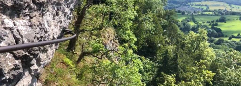
The name High Tor is fitting; the cliff face is sheer and dramatic, offering breathtaking views straight down into the Derwent Valley. From the top, walkers can gaze across to the wooded slopes of the opposite valley and watch the river meander through the village below. The drop is significant, and the exposed position means the wind can be fierce, so caution is essential. In the 18th and 19th centuries, the cliffs around Matlock Bath were a major tourist attraction, drawing visitors eager to experience the sublime power of nature. High Tor was often the highlight of their journey.
The Heights of Abraham
As the route progresses towards Masson Hill, walkers encounter the world-famous Heights of Abraham. This 60-acre estate sits atop a limestone promontory and has been attracting visitors since the 18th century. It is named after a ship rather than a biblical figure; the ship HMS Abraham captured a French vessel of the same name, and the owner of the estate, who had served in the Royal Navy, chose to commemorate the event.
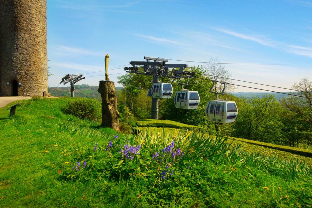
Today, the Heights of Abraham is best known for its cable car system, which carries visitors from Matlock Bath up to the summit. However, from the high-level walking route, you approach it from above, offering a unique perspective on the attraction. The estate is home to two show caves, the Great Masson Cavern and the Rutland Cavern, both of which were once worked for lead and fluorspar. The caves are a reminder of Derbyshire’s rich mining heritage, which shaped the landscape and the local economy for centuries. Even if you do not enter the attraction, the views from this section of the walk across the Derwent Valley are simply magnificent.
Masson Hill
The highest point of the walk is Masson Hill, which stands at 338 metres with a prominence of 55 metres. This summit rewards walkers with panoramic views that stretch across the Peak District. To the north, the gritstone edges of the Dark Peak are visible on a clear day. To the south, the rolling limestone hills of the White Peak unfold in a patchwork of fields and dry stone walls.
Masson Hill is geologically significant. It is composed of limestone and gritstone, a combination that is characteristic of the Peak District’s complex geological history. The summit area is also dotted with evidence of past industry. Lead mining was a major activity here from Roman times until the 19th century, and the scars of these workings are still visible in the landscape. The summit is a quiet spot compared to the busy valley below, offering walkers a moment of peace before the descent.
St Giles Church and the Graveyard
Located in the heart of Matlock, St Giles Church is one of the oldest places of worship in the area. Its origins date back to the Norman period, although much of the current building reflects later Victorian restoration. The church is dedicated to St Giles, the patron saint of cripples and lepers, which is a reminder of the medieval pilgrimage routes that once crossed this part of Derbyshire.
The graveyard at St Giles is a point of historical interest in its own right. Many of the headstones date back to the 18th and 19th centuries, and the inscriptions offer a fascinating glimpse into the lives of the local community. Among those buried here are families who worked in the lead mines and the textile mills that once lined the Derwent Valley. The churchyard also provides a shaded spot to pause and reflect, surrounded by yew trees that are believed to be several hundred years old.
Pic Tor War Memorial
Pic Tor is a prominent rock outcrop that overlooks Matlock Bath, and it is crowned by a striking war memorial. The memorial was erected after the First World War to honour the fallen soldiers from the local area. It stands on a natural vantage point, deliberately chosen so that the names of the dead would be forever remembered against the backdrop of the valley they fought to protect.
The memorial is a simple yet powerful structure. It is built from local stone and features a bronze plaque listing the names of those who lost their lives. The location is significant; Pic Tor itself is a landmark that has been used for defensive purposes since ancient times, and the addition of the war memorial creates a poignant link between the distant past and more recent history. The view from the memorial is one of the finest on the walk, looking directly down onto Matlock Bath and the winding River Derwent.
Lovers Walk
The return leg of the circular walk follows a path known as Lovers Walk. This romantic name belies a practical route; it is a level, wooded footpath that runs along the eastern side of the Derwent Valley, offering a gentle descent back to the start. The path is shaded by mature trees, including beech and oak, which create a cool and tranquil atmosphere.
Lovers Walk follows the course of the river and provides a completely different perspective on the landscape. Where the first half of the walk was exposed and high, this section is sheltered and intimate. The sound of the river accompanies you as you walk, and the dappled light filtering through the canopy creates a peaceful end to a challenging hike. The path eventually emerges at Derwent Gardens, a public park in Matlock Bath that has been a popular leisure destination since the Victorian era.
Other Points of Interest in Matlock Bath
The route also passes several other notable features. Giddy Ledge is a local name for a narrow and exposed section of the path on High Tor, where the drop is particularly sheer. It is not for the faint-hearted. Riber Castle, a gothic mansion built in the 19th century, is visible in the distance from various points on the walk. Tinkers Shaft and Great Masson Cavern are both associated with lead mining, and their entrances can still be seen near the Heights of Abraham.
In the valley below, Church Street and St Johns Road form the historic core of Matlock Bath, a village that grew into a fashionable spa resort in the 18th century. The Derwent Gardens, located at the end of Lovers Walk, offer a final opportunity to rest beside the river before completing the circuit.
Practical Advice for Walkers
This walk is demanding. With 480 metres of ascent over around 6 miles, it requires a good level of fitness and sturdy footwear. The paths can be rocky and uneven. Weather conditions in the Peak District are notoriously changeable, so waterproof clothing and additional layers are strongly recommended.
This circular walk is a journey through the heart of Derbyshire’s most cherished landscape. It combines physical challenge with rich history, dramatic geology, and ever-changing views. Whether you are a seasoned hillwalker or a curious visitor to the Peak District, this route offers an unforgettable day out.
🥾 Explore Near Matlock Bath Circular Walk (6 Miles)
Discover walks, attractions, pubs, and bus stops within the local area
- Bakewell Visitor Centre 8 miles
- Robin Hood's Stride (2.7 miles) ✨ NEW 5.1 miles
- Carsington Water Circular (8 miles) ✨ NEW 5.7 miles
- Youlgreave via Lathkill Dale (7.6 miles) ✨ NEW 6.6 miles
- High Peak Trail via Minninglow Hill (3 miles) ✨ NEW 6.6 miles
- The White Horse & The View at Woolley Moor 4.5 miles
- The Bluebell, South Wingfield 5.1 miles
- The Peacock at Rowsley 5.3 miles
- Fairfield Loft, Fairfield Snug & Stamp Coffee Shop 4.2 miles
- Peak Village 5.4 miles
- Highfield House Farm Shop & Tea Rooms 5.5 miles
- Lizzie Mullaney Signature Stays 0.9 miles
- Rewilded Retreats 1.5 miles
- Yew Tree Farm 1.6 miles
- Mount Cook 2.1 miles
- The Heights of Abraham 0.2 miles
- Peak District Lead Mining Museum 0.6 miles
- Gulliver’s Kingdom, Matlock Bath 0.7 miles
- Crich Tramway Village 3.6 miles
- 🚌 White Lion (Adj) ↓ 158 0.0 mi 158 ✨ NEW 📋 Timetable
- 📍 Distances are straight-line (as the crow flies) and approximate.
🎪 Coming Up
📍 Distances are straight-line approximations.
🗓️ Plan Your Day
Nearby services: 6.1, 63, 110, 111, 140, 141, 143, 143A, 157, 158, 159, 169, 172, 470, TP, X17 · Live times
)