



Carsington Water Circular (8 miles)
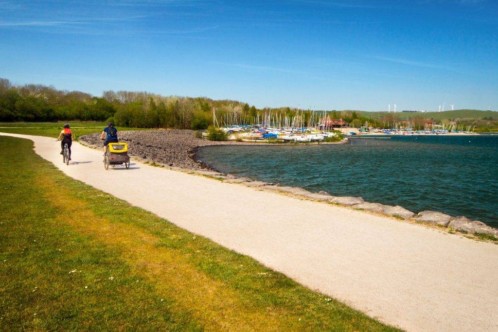
A great day out starting at the Carsington Water Visitors Centre, visiting Stones Island then taking a clockwise route around the lake. The route follows well-maintained gravel tracks and paths around England’s ninth-largest reservoir, offering continuous views of the water and surrounding Derbyshire hills.
⚠️ Please note: This route has been created and shared by an Outdoor Active community member. It has not been checked or verified by Let’s Go Peak District. Please read the full walk description carefully, check weather and ground conditions before setting out, and look to community reviews and comments on Outdoor Active for up-to-date feedback. Always follow the Countryside Code.
View Full Route on Outdoor Active ↗Points of interest on route:
Carsington Water – England’s ninth-largest reservoir, managed by Severn Trent Water to manage the flow of the River Derwent. Completed in 1992, it offers continuous views of the water and surrounding Derbyshire hills. It’s also a prime spot for birdwatching, with species like little owl, little grebe, and common tern often seen.
Stones Island – A small, man-made island featuring a modern interpretation of a prehistoric stone circle. Great stone slabs line a spiralling path, with portholes bored at various heights that frame different views of the reservoir and countryside.
The Bombing Tower – Officially known as the RAF Quadrant Tower, this brick and concrete structure dates from the early 1940s. It was used by the RAF to plot bomb drops in the Henmore Valley during World War II.
The Dam – The main dam at Carsington Water is an impressive feat of engineering. Standing 1,100 metres long and 35 metres high, it holds back the reservoir and offers great views across the water.
The Wood Carvings – Look out for impressive wooden sculptures along the route, including a very tall carving of a sheep and shepherd’s crook near the car park, as well as a carved hut and chair found in the fields.
Carsington Water Visitors Centre – The main hub on the west shore, featuring a restaurant with ceiling-to-floor views of the reservoir, a shop, and an ice-cream parlour. It’s also the starting point for the walk.
The Kugel Stone Fountain – A fascinating one-tonne ball of solid granite, 90cm in diameter, that rests on a thin film of water. The water pressure allows visitors to spin the heavy ball with just one hand – a fun and memorable experience.
🥾 Explore Near Carsington Water Circular (8 miles)
Discover walks, attractions, pubs, and bus stops within the local area
- Ashbourne Information Point 4.8 miles
- Tissington Walk via Parwich (4 miles) test ✨ NEW 4.1 miles
- High Peak Trail via Minninglow Hill (3 miles) ✨ NEW 5 miles
- Matlock Bath Circular Walk (6 Miles) ✨ NEW 5.7 miles
- Dales of the River Dove (8 miles) ✨ NEW 5.7 miles
- Wildhive, Callow Hall 5.2 miles
- Farmyard Inn, Youlgrave 8 miles
- Hopton Hall Holiday Cottages 1.3 miles
- Standlow Farm 1.8 miles
- Stainsborough Hall 1.9 miles
- Stainsborough Cottages 1.9 miles
- Gulliver’s Kingdom, Matlock Bath 5 miles
- Peak District Lead Mining Museum 5.2 miles
- The Heights of Abraham 5.6 miles
- Great British Car Journey 6.2 miles
- 🚌 Visitor Centre (Adj) ← 110 111 0.0 mi 110, 111 ✨ NEW 📋 Timetable
- 📍 Distances are straight-line (as the crow flies) and approximate.
🎪 Coming Up
📍 Distances are straight-line approximations.
🗓️ Plan Your Day
Nearby services: 110, 111 · Live times
)